Chasing the Swell: How Hurricane Season Turns America's Coastlines Into a Surfer's Playground
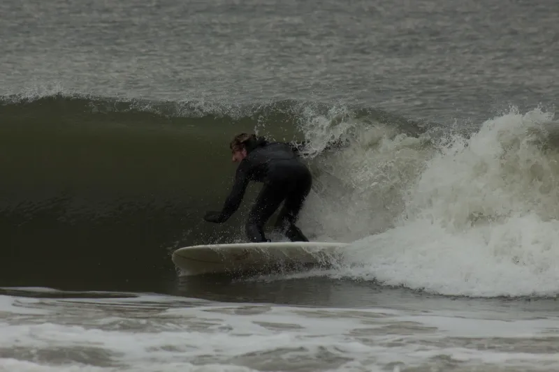
Most people hear "hurricane warning" and start boarding up windows. A very different crowd hears the same words and starts loading surfboards onto roof racks.
Welcome to the world of swell chasing — part meteorology obsession, part road trip culture, part pure adrenaline. Every summer and fall, as tropical systems crank up across the Atlantic basin and the Gulf of Mexico, a loose network of dedicated wave hunters begins plotting routes along America's coastlines in pursuit of the swells that only storms can conjure. It's one of the most exhilarating — and misunderstood — subcultures in the surf world, and it plays out across thousands of miles of American shoreline.
The Science Behind the Magic
Here's the thing about hurricane swells: the storm itself doesn't need to make landfall to deliver the goods. In fact, a direct hit is usually the last thing a swell chaser wants. What matters is the storm's position, its forward speed, and the fetch — the uninterrupted stretch of open ocean over which wind energy gets transferred into wave energy.
When a hurricane stalls or slowly tracks up the Atlantic seaboard, it acts like a massive wave-making machine, generating long-period groundswells that radiate outward in all directions. Those swells can travel hundreds — sometimes thousands — of miles before hitting a coastline, arriving as powerful, clean, well-organized waves that bear almost no resemblance to the chaotic chop you'd expect near the storm's core.
Surfers call this "swell energy," and they track it the same way a sailor tracks weather systems. Apps like Surfline and Magic Seaweed, combined with NOAA's buoy data and National Hurricane Center forecast models, have turned swell forecasting into something close to a science. The best chasers can read a five-day forecast and tell you not just when waves will arrive, but which direction they'll be coming from, what period to expect between sets, and which specific breaks will light up as a result.
The Road Trip Is Part of the Experience
What makes swell chasing genuinely unique as a travel pursuit is that it's inherently mobile. You don't book a hotel two weeks out and wait for the waves to come to you. You watch the storm, you make a call, and then you drive.
The East Coast is the primary proving ground for this kind of adventure. As a tropical system tracks northward, the swell window shifts with it. A storm sitting off the Carolinas might be sending energy to Jacksonville, Florida in the morning and Cape Hatteras by evening. Chasers often find themselves hopping up or down US-1 or Highway 17 in a kind of rolling wave hunt, chasing the optimal angle as conditions evolve.
The Outer Banks of North Carolina are practically sacred ground in this world. Cape Hatteras, in particular, is notorious for producing some of the most powerful hurricane-season surf on the East Coast. The geography is ideal — barrier islands with deep water close to shore, multiple exposed breaks facing different directions, and a long stretch of accessible beach road that makes repositioning quick and easy. During a productive swell event, the Hatteras parking lots fill up with out-of-state plates from Virginia, Maryland, New Jersey, and beyond.
Further south, spots along the Space Coast in Florida, particularly around Sebastian Inlet, have their own devoted swell-chasing community. The inlet's configuration funnels energy in ways that can produce surprisingly hollow, powerful waves when the right storm is positioned offshore.
The Gulf Side Has Its Own Story
The Gulf of Mexico doesn't get nearly enough credit in the hurricane swell conversation, but it absolutely deserves a spotlight. When a tropical system spins up in the Gulf — or tracks along the northern coast — spots from the Florida Panhandle all the way to South Padre Island in Texas can fire in ways that would surprise anyone who thinks of the Gulf as a flat, forgettable body of water.
Pensacola Beach and the beaches around Fort Walton have seen legitimate overhead-plus surf during Gulf storm events. The Texas coast, particularly around Galveston and the Bolivar Peninsula, has its moments too — short-lived, maybe, but memorable for the small community of surfers who call the Gulf home year-round and know exactly when to paddle out.
Road-tripping the Gulf Coast during hurricane season has its own rhythm. Highway 98 through the Panhandle and US-87 along the Texas coast become swell-chasing corridors when conditions align, with wave hunters pulling over at every beach access point to check the surf before moving on.
Respect the Power — and the Process
It would be irresponsible to write about hurricane swells without being direct about the risks. The same storm energy that produces incredible waves can also generate dangerous rip currents, shore break, and rapidly shifting conditions. The surf that looks manageable from the parking lot can be a different beast once you're in the water.
Experienced swell chasers operate with a strict code: they know their limits, they read the water before paddling out, and they never surf alone in serious conditions. Many carry inflatable vests and communicate their location to people onshore. Chasing swells for the first time isn't something to do on a whim — it's a pursuit that rewards experience and preparation.
It's also worth noting the ethical dimension. Some of the breaks that light up during hurricane season are in coastal communities that may be simultaneously dealing with storm prep or recovery. Reading the room matters. Showing up at a beach town that's boarding up its storefronts and treating it like your personal surf destination is, at best, tone-deaf. Timing, judgment, and basic human decency are part of the equation.
When to Go, and What to Watch
Hurricane season officially runs from June 1 through November 30, but the peak window for swell activity on the East Coast is generally late August through October. That's when the Atlantic basin is most active and the conditions that produce long-period swells are most likely to develop.
For anyone who wants to dip a toe into the swell-chasing world, the Outer Banks in September is a solid starting point. Book a flexible rental — something with a week-to-week option — and keep your eyes on the NHC advisory updates and buoy readings. When a system starts developing and the forecast models show it tracking in the right direction, that's your cue to load the car.
Bring layers. Bring patience. Bring a backup plan for flat days, because there will be flat days. And when the swell finally arrives — when you're standing on a beach and the horizon starts stacking up with sets that the ocean was building for days — you'll understand immediately why people chase storms to the sea.