Paddle to the Edge: America's Most Wild and Wonderful River-to-Ocean Gateways
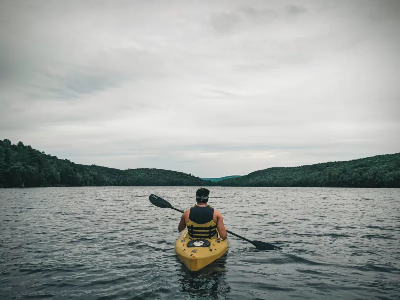
There's a moment, somewhere out on the water, when you stop paddling and just let the current carry you. The river you've been following for miles starts to widen, the banks grow distant, the water shifts from tea-dark to something greener and more restless — and suddenly you realize you're no longer entirely on a river. You're not quite on the ocean either. You're in between, and honestly? That's exactly where the good stuff happens.
River mouths — those transitional zones where freshwater systems empty into tidal bays, estuaries, and open coastline — are some of the most biologically rich and visually dramatic paddling destinations in the entire country. They're also wildly underrated. While most kayakers are booking guided sea tours or floating calm lake circuits, the folks who've discovered these confluence zones are quietly having the time of their lives. Let's fix that.
Why River Mouths Hit Different
The science is worth understanding because it makes the paddling experience feel even more epic. When freshwater meets saltwater, you get what's called an estuary — a brackish mixing zone that acts as a nursery, feeding ground, and migratory stopover for an almost absurd variety of wildlife. Nutrients flowing down from inland watersheds collide with the tidal energy of the coast, creating conditions that support everything from juvenile salmon to migratory shorebirds to bottlenose dolphins cruising the shallows.
For kayakers, this translates to constantly changing water conditions, incredible wildlife sightings, and scenery that shifts dramatically over just a few miles of paddling. One hour you're gliding through calm, reed-lined channels. The next, you're reading tidal currents and navigating open water with real chop. It keeps you engaged in a way that purely flatwater or purely coastal paddling sometimes doesn't.
The Columbia River Bar: Pacific Power
If you want to talk about dramatic, you start with the Columbia River. The fourth-largest river in the US by volume meets the Pacific Ocean at the Oregon-Washington border with enough force that mariners have been calling the area the "Graveyard of the Pacific" for centuries. Over 2,000 shipwrecks sit offshore. That should tell you something.
Obviously, you're not paddling the bar itself in a sea kayak — that would be genuinely dangerous and probably inadvisable in the extreme. But the lower Columbia and its surrounding estuary system offer some of the most compelling paddling in the Pacific Northwest. Put in near Astoria, Oregon, and you can explore the Youngs Bay system, the Lewis and Clark National Historical Park waterways, and a sprawling network of sloughs and tidal channels that most visitors completely overlook. Bald eagles are almost embarrassingly common here. Harbor seals pop up without warning. On the right morning, with the mist still sitting low over the water, it feels like paddling through a nature documentary.
Plan your trip around the tides — incoming tides push you upriver, outgoing tides carry you back toward the coast. Work with them rather than against them and you'll cover serious ground without wearing yourself out.
The Mississippi Delta: America's Bayou Maze
Few river systems in the world carry the cultural and geographic weight of the Mississippi, and where it finally meets the Gulf of Mexico in southeastern Louisiana, it does so in spectacular, sprawling fashion. The delta is a labyrinth of distributary channels, cypress swamps, coastal marshes, and open bays that stretches across roughly three million acres of some of the most ecologically important land in North America.
Kayaking here is an exercise in getting happily lost. Routes through the Atchafalaya Basin — the Mississippi's largest distributary — wind through ancient swamp forest draped in Spanish moss, past great blue heron rookeries and alligator-watched banks, and eventually open into vast coastal marshes where the land quite literally disappears into the Gulf. Birders lose their minds here during spring and fall migration. The delta sits directly on the Mississippi Flyway, one of the continent's major bird migration corridors, so the wildlife viewing can be genuinely jaw-dropping.
Base yourself in Houma or Morgan City for easy access to Atchafalaya Basin launch points, or head further south toward Cocodrie for guided paddling trips into the outer delta marshes. Just know that navigation here requires solid map skills or a local guide — the channels shift seasonally and GPS doesn't always capture the current reality on the water.
Chesapeake Bay Tributaries: The Mid-Atlantic Sweet Spot
The Chesapeake Bay is essentially one enormous estuary fed by dozens of significant rivers, and the spots where those rivers transition into the bay's brackish waters are paddling gold. The Patuxent, the Rappahannock, the Potomac — each one offers its own character and its own wildlife community as it widens toward the bay.
The Patuxent River estuary in Maryland is particularly worth your time. The lower section runs through Jug Bay Wetlands Sanctuary and the Patuxent River Park system, offering miles of protected paddling through freshwater tidal marsh before the river broadens and the water takes on that characteristic Chesapeake mix. Ospreys nest in almost every dead snag. River otters are common enough that you stop being surprised by them after the third or fourth sighting. It's accessible, well-marked, and genuinely beautiful — a solid option if you're new to estuary paddling and want to build your confidence before tackling something more remote.
The Rogue River Meets the Pacific: Oregon's Wild Card
For paddlers who want something more rugged and less trafficked, the Rogue River estuary near Gold Beach, Oregon, deserves serious attention. The Rogue runs wild through some of the most remote canyon country in the lower 48 before calming slightly in its final miles and emptying into the Pacific through a relatively narrow bar backed by sand dunes and coastal forest.
The estuary itself is calm enough for confident recreational kayakers, and the wildlife density is remarkable — harbor seals haul out on sandbars, black bears occasionally wander the riverbanks, and the salmon runs draw both bald eagles and river guides in roughly equal numbers. The surrounding Rogue River-Siskiyou National Forest provides a dramatic backdrop that makes every photo look professionally composed.
Gold Beach has a small but solid outdoor outfitter scene, and guided kayak tours of the lower river and estuary are available if you'd rather have someone else handle navigation.
Getting Ready to Go
A few practical notes before you start loading your car. Estuary paddling spans a wide range of skill levels depending on the specific location, but tidal awareness is non-negotiable everywhere. Download a tide chart app before you launch, understand how tidal currents affect your chosen waterway, and always let someone know your float plan.
Dry bags for your gear, a VHF radio for anything near open coastal water, and solid sun protection are your baseline kit. Many of these locations also fall within protected areas with specific permit or access requirements, so check ahead with the relevant land management agencies before you show up expecting a casual launch.
The river mouths are out there, doing their thing — mixing, churning, feeding entire ecosystems, and waiting for paddlers willing to follow the current all the way to the edge. Go find one.