When the Ocean Rages: How Storm Chasers and Scientists Are Chasing Hurricane-Driven Sea Events
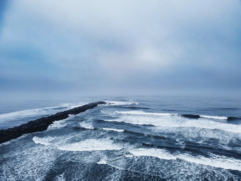
Most people see a tropical storm system spinning toward the coast and immediately start thinking about plywood, bottled water, and evacuation routes. But there's a different kind of traveler out there — one who sees that same swirling mass of atmospheric fury and starts planning a road trip.
They're storm chasers of the sea. And while the concept might sound reckless, the reality is far more nuanced, calculated, and honestly, kind of fascinating.
What the Ocean Does During a Hurricane (That Nobody Talks About)
When a major tropical system churns across open water, it doesn't just create wind and rain. It fundamentally reorganizes the ocean. Swells generated hundreds of miles offshore can arrive at coastlines long before the storm itself, stacking up into waves that surf forecasters describe in near-religious terms. Sea surface temperatures shift. Pressure gradients create rare cloud formations at the horizon. And in certain conditions — particularly when warm Gulf Stream water meets storm-cooled surface layers — you get atmospheric-oceanic interactions that scientists are still trying to fully understand.
Dr. Lisa Moreno, a physical oceanographer who has spent years studying hurricane-driven upwelling events along the Mid-Atlantic shelf, puts it plainly: "A major hurricane is basically a giant mixing machine. It pulls cold, nutrient-rich water up from the deep and redistributes heat in ways we can actually track from satellites. From the shoreline, you're seeing the visual signature of an event happening hundreds of feet underwater."
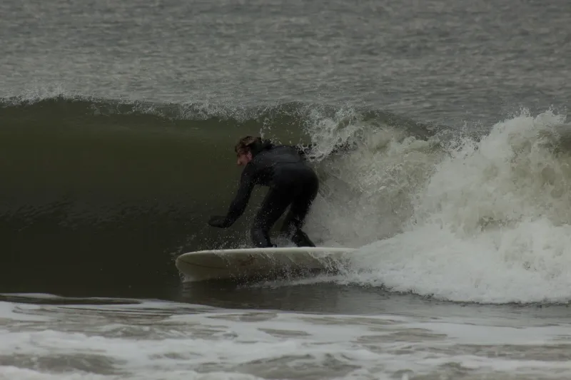
That visual signature — churning green water, dramatic surf lines, eerie pre-storm skies — is exactly what draws storm photographers and adventure travelers to the coast when everyone else is heading inland.
The People Who Drive Toward the Storm
Marcus Tillman has been photographing hurricane swells along the East Coast for over a decade. Based out of Wilmington, North Carolina, he's developed what he calls a "tactical approach" to storm positioning — one that involves obsessively monitoring buoy data from the National Oceanic and Atmospheric Administration (NOAA), cross-referencing surf models, and identifying coastal geography that amplifies wave energy without putting him in direct danger.
"The Outer Banks are incredible for this," Tillman says. "You've got barrier islands with virtually no natural obstruction, and when a storm is sitting offshore at the right angle, the swells wrap around Cape Hatteras in a way that's unlike anything else on the Eastern Seaboard. I've shot 30-foot faces there during Category 2 systems that were still 200 miles out to sea."
He's quick to add that he's never positioned himself inside an active storm's projected landfall zone. The goal, he explains, is to intercept the energy — not the destruction.
Reading the Forecast Like a Storm Chaser
If you want to witness hurricane-driven ocean phenomena safely, understanding a few key data sources goes a long way. The NOAA National Hurricane Center issues track forecasts every six hours, and learning to read the cone of uncertainty is essential. Equally important are offshore buoy readings, which show real-time swell heights, wave periods, and sea surface temperatures at stations positioned throughout the Atlantic and Gulf.
Surf forecasting sites like Surfline and Magic Seaweed translate that raw data into accessible swell predictions, and during active hurricane seasons — typically peaking between August and October — they become essential tools for anyone trying to time a coastal visit.
The sweet spot most storm observers look for is a system sitting 150 to 300 miles offshore, moving slowly enough to generate long-period swells but far enough away to keep shoreline conditions manageable. That window can last anywhere from 12 hours to several days, depending on the storm's track.
Best Coastal Vantage Points for Storm-Driven Ocean Events
Cape Hatteras, North Carolina remains the crown jewel of East Coast storm watching. The cape's unique geographic position — jutting far into the Atlantic — means it intercepts swell energy from multiple directions simultaneously. The Cape Hatteras National Seashore offers wide, open beach access, and the lighthouse itself provides an elevated perspective that storm photographers have been exploiting for generations.
Montauk, New York is another go-to. The eastern tip of Long Island catches the full brunt of any northward-tracking Atlantic storm, and the rocky bluffs near Montauk Point State Park give you a front-row seat to surge formations that can be genuinely spectacular — and genuinely dangerous if you get too close.
Galveston Island, Texas sits in a complicated position for Gulf storm watching. It's low-lying and vulnerable to surge, so actual storm landfalls here are not observation opportunities — they're evacuation situations, full stop. But in the days before a Gulf system makes landfall farther down the coast, Galveston's long seawall promenade offers a dramatic view of building swells and rapidly changing skies.
St. Augustine, Florida offers something slightly different: the chance to witness storm-driven bioluminescence. When hurricane-force winds churn coastal waters rich with dinoflagellates, nighttime surf can light up in electric blue — a phenomenon that's equal parts eerie and otherworldly. It doesn't happen every storm, but when it does, storm chasers who know to look for it describe it as one of the most surreal experiences the ocean has to offer.
The Ethics and Safety of Storm Observation
Let's be honest about something: storm chasing of any kind carries real risk, and the ocean amplifies that risk considerably. Rogue waves, unexpected surge, rapidly deteriorating road conditions — these aren't abstract concerns. Every year, people are injured or killed by underestimating coastal storm conditions.
The community of serious storm observers operates by a few unspoken rules. Never position yourself on beaches or jetties during active surge events. Always have a vehicle pointed away from the water with a clear exit route. Monitor emergency alerts and local evacuation orders — if officials say leave, you leave. Period.
There's also an ethical dimension worth considering. Traveling to a region that's preparing for a potentially devastating storm requires sensitivity. You're a visitor in someone else's emergency. Keep a low profile, support local businesses if it's safe to do so, and stay out of the way of emergency personnel and evacuating residents.
Why This Kind of Travel Changes You
There's something that happens when you're standing on a windswept shore watching the ocean reorganize itself in real time — swells stacking on the horizon, the barometric pressure dropping so fast you can feel it in your chest, the air tasting like something electric and ancient. It's humbling in a way that very few travel experiences can match.
Storm photographers talk about it constantly. Oceanographers reference it when explaining why they got into their field. Even casual observers who've stumbled into a pre-storm coastal scene without fully understanding what they were witnessing tend to describe it as a turning point — a moment when the ocean stopped being a backdrop and became something alive.
That's what Ocean Wanderers is ultimately about, isn't it? Not the beach chairs and the frozen drinks — though those have their place — but the moments when the sea reminds you just how vast and powerful and indifferent it really is. Storm chasing, done thoughtfully and safely, is one of the most direct routes to that reminder.
The forecast is calling for something significant offshore. You know where to find us.