Follow the Current: A Traveler's Guide to North America's Wildest Underwater Migration Corridors
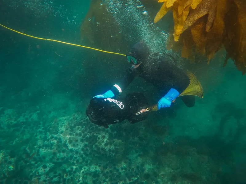
Most road trips follow a map. This one follows a current.
Running along the western edge of North America, a chain of cold, nutrient-pumped ocean corridors quietly fuels some of the most spectacular underwater biodiversity on Earth. Scientists call them upwelling zones. Marine biologists track the migrations they enable. And for travelers willing to strap on a mask and fins, these liquid highways offer a front-row seat to a world most people never get to see.
Think of it like the Pacific Coast Highway — except it runs underwater, and the traffic is made up of rockfish, sea otters, leopard sharks, and migrating gray whales.
Three regions stand out as must-stops along this aquatic route. Each one is distinct in character, accessible to snorkelers of varying experience levels, and absolutely worth building a coastal road trip around.
Why Ocean Currents Create Underwater Hotspots
Before you pack the wetsuit, it helps to understand why these places are so alive.
Along the Pacific Coast, prevailing winds push surface water offshore, pulling cold, nutrient-dense water up from the deep in a process called coastal upwelling. That cold water is basically liquid fertilizer — it feeds massive blooms of phytoplankton, which in turn feed zooplankton, which feed everything else. Kelp, one of the fastest-growing organisms on the planet, thrives in these cold, clear conditions, building towering underwater forests that shelter hundreds of species.
The result is a layered, interconnected ecosystem that functions a lot like a terrestrial forest — with canopy, understory, and floor — except it's swaying in a gentle current sixty feet underwater. Marine life doesn't just live here. It migrates through, breeds here, hunts here, and shelters here during long ocean journeys.
For travelers, that means if you time your visit right, you're not just looking at a reef. You're watching a migration in real time.
Stop One: The Monterey Bay Corridor, California
If there's a Grand Central Station of Pacific marine life, it's Monterey Bay. The Monterey Bay National Marine Sanctuary stretches 276 miles of coastline and encompasses one of the deepest underwater canyons in North America — a geological feature that dramatically amplifies upwelling and concentrates marine life in ways that still surprise researchers.
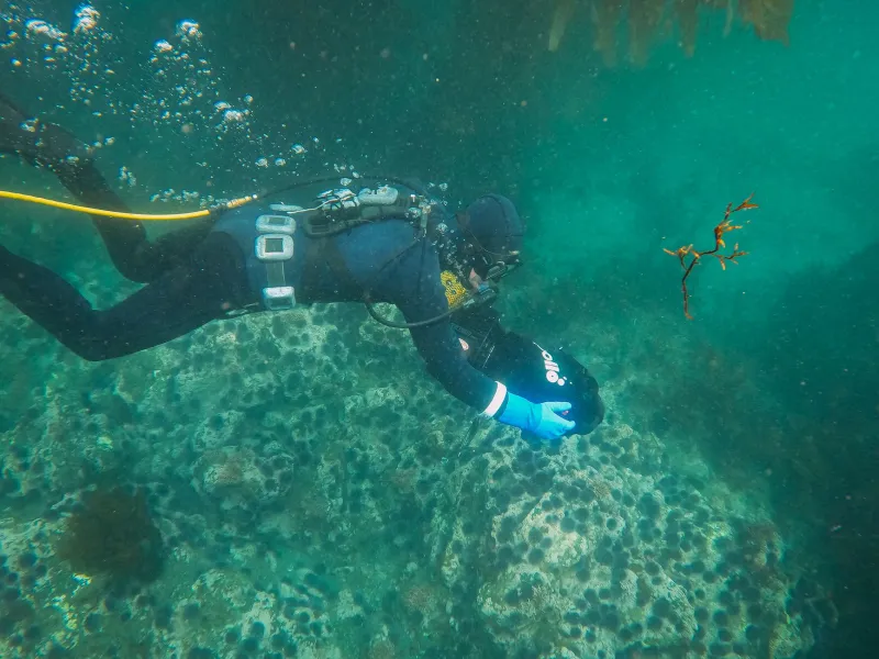
For snorkelers and free divers, the kelp forests off Lover's Point in Pacific Grove are the obvious starting point. Visibility can hit 30 feet on a calm day, and the kelp canopy is dense enough to feel genuinely cathedral-like. Giant sea bass drift through the columns. Garibaldi — California's official state marine fish, a vivid orange that looks almost tropical — dart between holdfasts. Harbor seals are curious and frequent.
The road trip angle here is strong. Highway 1 through the Monterey Peninsula is one of the most scenic drives in the country. Base yourself in Pacific Grove or Carmel-by-the-Sea, grab a guided snorkel tour through Monterey Bay Dive Expeditions or Breakwater Cove, and plan to spend at least two days in the water.
Best time to visit: August through November, when winds ease and visibility peaks. Water temps hover around 55–60°F, so a 5mm wetsuit is non-negotiable.
Stop Two: The Channel Islands, Southern California
Sixty miles off the coast of Ventura, five islands sit in a stretch of water where two major current systems collide — the cold California Current pushing down from the north and the warmer Southern California Countercurrent nudging up from the south. That collision creates a biological mixing zone unlike almost anywhere else on the West Coast.
The Channel Islands National Park protects this entire system, and it shows. Kelp forests here are some of the healthiest in the state — partly because the islands are hard to reach and lightly trafficked. Island Packers runs ferry service from Ventura Harbor to Santa Cruz Island, the largest and most snorkel-accessible of the five. Once there, Scorpion Anchorage is the go-to entry point, with kelp beds starting just offshore and sea caves accessible by kayak or swim.
What makes the Channel Islands corridor special is the diversity of the mixing zone. On any given dive, you might encounter species typical of colder Northern California waters — like lingcod and cabezon — alongside warmer-water visitors like the occasional yellowtail or even a hammerhead in late summer. It's genuinely unpredictable in the best possible way.
Practical note: There are no restaurants or lodging on the islands. Camp at Scorpion Ranch Campground and pack everything in. It's worth every bit of the effort.
Stop Three: The Kelp Highways of Vancouver Island, British Columbia
Okay, technically this one crosses into Canada — but it's close enough to the US border, and dramatic enough, that it absolutely earns a place on this route. The west coast of Vancouver Island, particularly around Ucluelet and Tofino, sits at the northern end of the same upwelling system that powers Monterey and the Channel Islands. Here, the currents run stronger, the kelp grows denser, and the wildlife gets considerably bigger.
Bull kelp forests off Barkley Sound can reach 120 feet in height. Wolf eels lurk in rocky crevices. And from late March through May, gray whales pass through in the thousands during their annual migration from Baja California to Alaska — one of the longest migrations of any mammal on Earth. Snorkeling alongside a gray whale feeding corridor is an experience that frankly defies description.
Guided snorkel and dive tours operate out of both Ucluelet and Tofino. Ocean Outfitters and Remote Passages are two well-regarded operators. The drive up Vancouver Island from Victoria along Highway 4 is spectacular — old-growth rainforest meets wild Pacific coastline in a way that feels genuinely remote.
Water temps here drop to the low 50s even in summer, so a drysuit or heavy wetsuit is the call. But the payoff is extraordinary.
How to Travel These Corridors Responsibly
These ecosystems are resilient, but they're not invincible. A few ground rules go a long way.
Never touch the kelp or the seafloor. Kelp holdfasts anchor the entire forest structure — dislodging them causes damage that takes years to recover. Keep your fins up and your buoyancy neutral. Skip the gloves; bare hands make you more aware of what you're touching.
Book guided tours whenever possible, especially in protected areas like Channel Islands National Park and Monterey Bay Sanctuary. Local guides know the access points, the seasonal restrictions, and the conditions. They also tend to know where the good stuff is hiding.
And leave the underwater camera housing at home for at least one dive. Seriously. Just look.
The Route, Simplified
If you're building a road trip around all three stops, start in Vancouver Island, drive south through Washington and Oregon — both of which have their own underrated kelp snorkel spots worth exploring — then hit the Channel Islands and finish in Monterey. The whole loop, done right, takes two to three weeks and covers some of the most spectacular coastal driving in North America.
The ocean doesn't move in straight lines. Neither should you.